
What services we provide
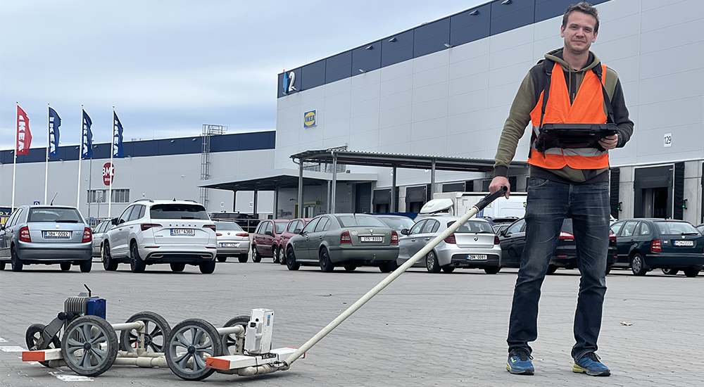
Georadar survey
Reveal hidden anomalies below the surface with our GPR
Thanks to advanced GPR technology, we can accurately identify anomalies below the surface - areas with different conductivity or permittivity compared to the surrounding bedrock. This allows us to find underground passages, caves, utilities, graves, wells and much more. Rely on our expertise to discover what remains hidden to the naked eye! More info
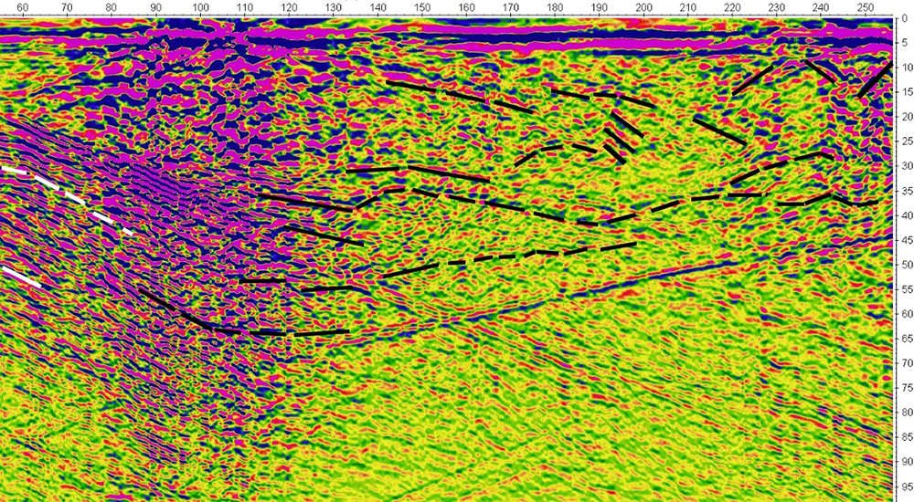
Evaluation of radargrams
Do you have a GPR but don't know how to process the measured data correctly?
Leave it to us! We offer a professional service to evaluate your GPR data. Thanks to our advanced software Spirio SW we can process and filter even radargrams that you only have in image form. Get the most out of your data with our expert help!
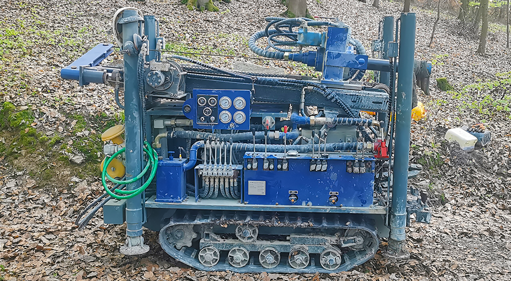
Drilling an anomaly
Precise drilling of anomalies - with us you can be sure of the right solution
We always choose the most suitable method for drilling anomalies according to the depth and composition of the subsoil. We use both hand drills for shallower depths of up to a few metres and our own D180 drilling rig, which can handle depths of up to 160 metres. This technology is ideal not only for exploration work, but also for drilling wells.
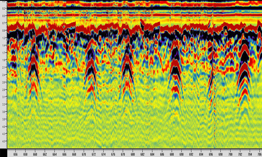
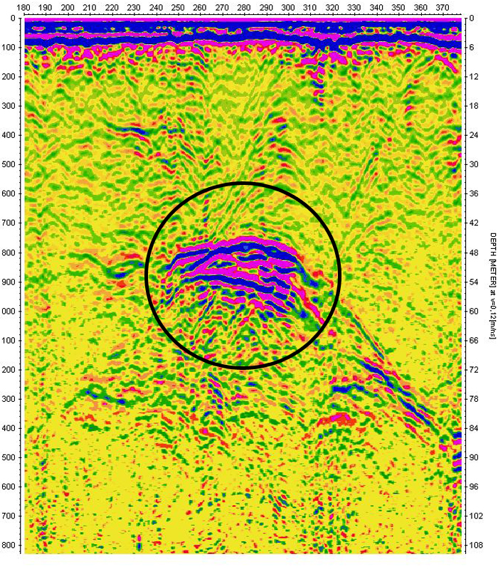
Signal from the limestone depths of Blansko
This makes our ROTEG GPR truly unique!
Examples of measurements
GPS tracking
Georadar ROTEG records GPS position with an accuracy of 1 meter. In a relatively short period of time, we can measure a larger area without having to precisely locate each profile and then easily locate the anomalies found, for example in Google Earth, where a radargram with the anomaly can be associated with each GPS point. An illustrative example of a field survey in Vysocina (CZ) in the video below.Old wells and cellars
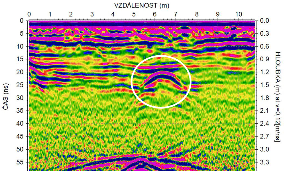
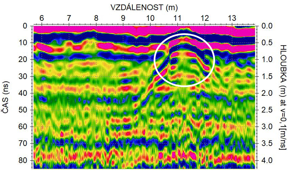
"I need to find an old well/cellar on the property." We hear this phrase a lot. This is the most common survey for individuals.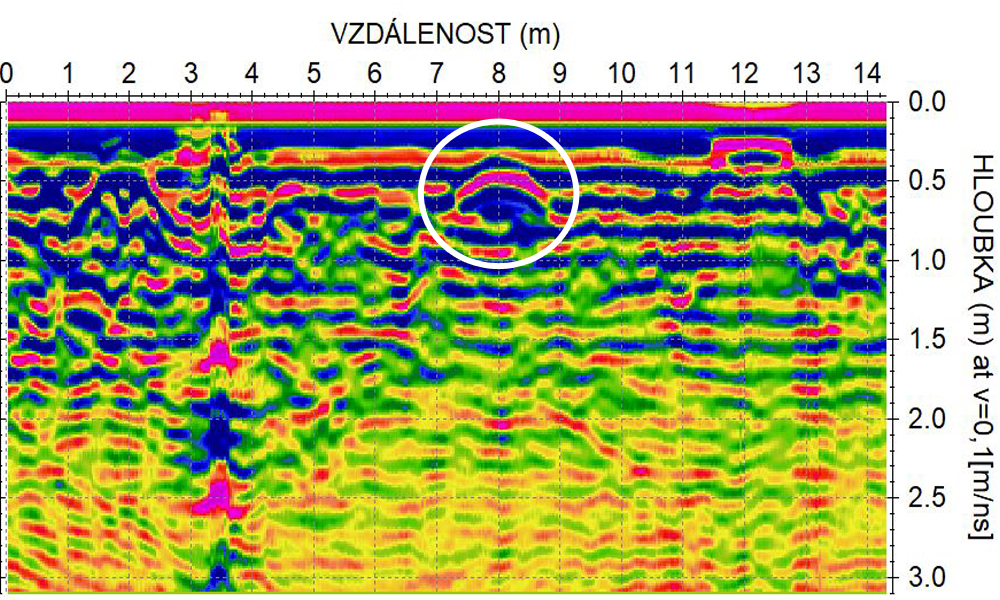
covered well
vaulted cellar
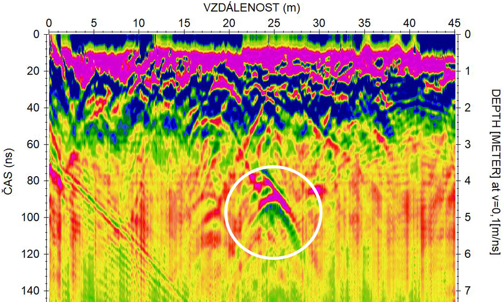
Routing of utility networks
When the project plans do not match reality and the pipes/cables run in a different direction. Do you want to make sure you don't interrupt the utility lines during excavation?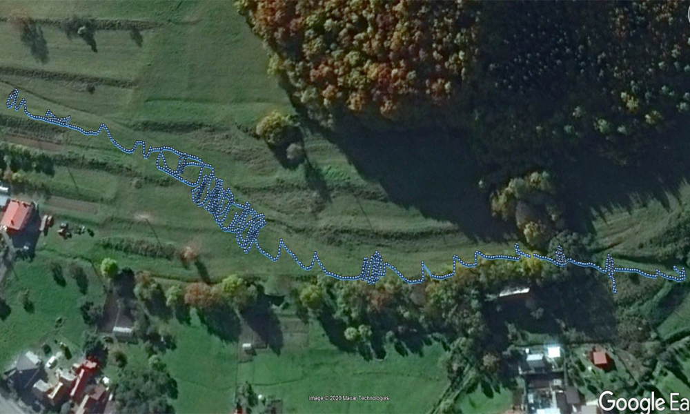
this is also how the trajectory of a water pipeline can look like :)
part of the radargram from the water pipeline routing
600 mm diameter sewer pipe
inclined crossing over the Malešická sewer
Underground corridors
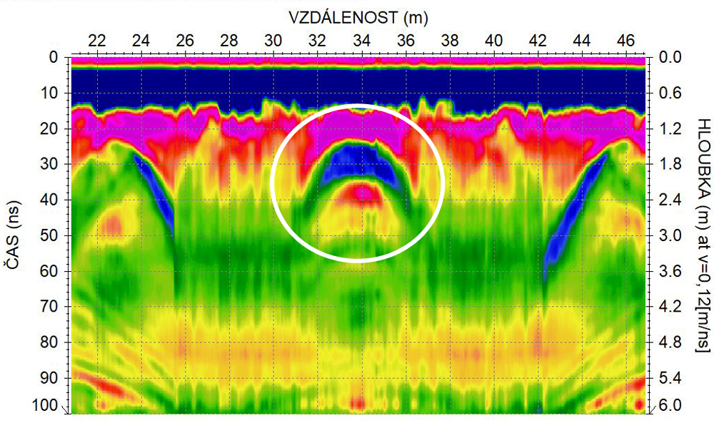
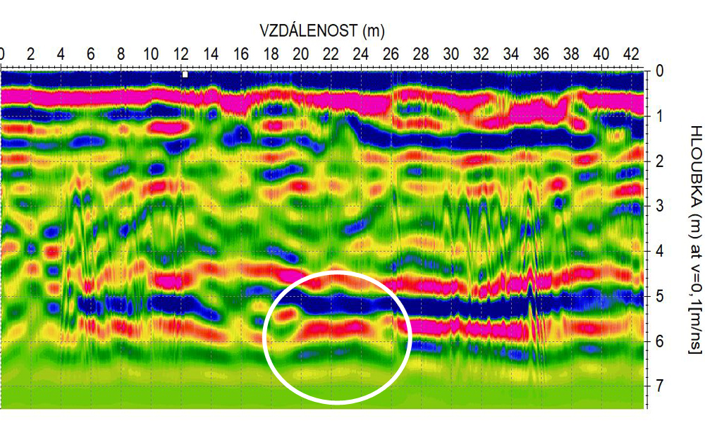
Is there an underground passageway leading out of the castle? Do I have an underground passageway on my property? We can answer these questions quickly. We can locate underground passages up to several tens of meters deep.
corridor dug in the clay
passage in the rock (4.5 m underground)
Caves
When searching for caves, we cooperate with speleologists who have an overview of the situation in karst areas and have well-mapped known caves. Caves recorded by Georadar are thus easily verifiable with those already discovered. Often, we also find caves in their surroundings that have not been discovered before.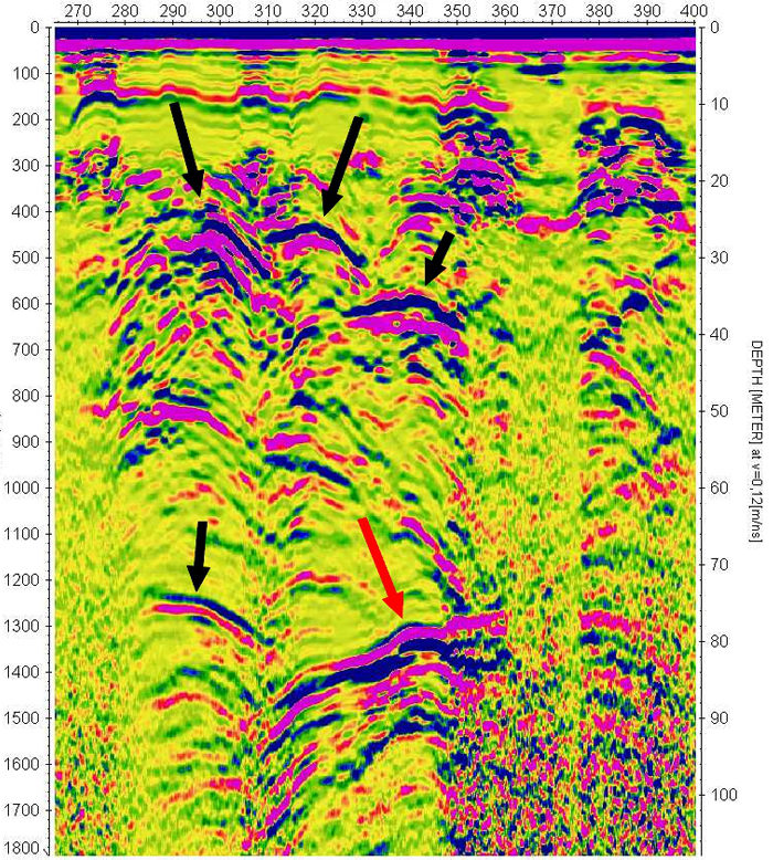
exploration in the karst area of Blansko (the Old Amateur Cave is captured at a depth of about 80 m - red arrow)
a previously undiscovered cave at a depth of around 50 metres
Our customers include:
Construction (Strabag, Metrostav, Skanska, Granson, PS Brno, etc.)
Pavement and subgrade inspection (Viakontrol, University of Pardubice)
Scientific institutions / universities (Mendel University in Brno, VŠB-TUO Ostrava)
Sewerage and water supply (Termonta Praha, Zepris)
Water management (HG partner, Profivoda)
Geodesy (SK Geodeti, Geovia)
Crane work (Hanyš)
Real estate (FM&S, Realing, Skanska Reality)
Archaeologists, geologists, mineralogists, mining companies, criminal police . .
But also other geological companies that need deep GPR surveys.
Expeditions
Mongolia - Gobi Desert
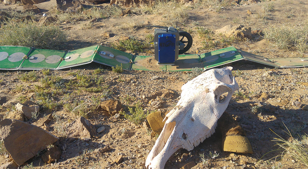
2017
Germany - Lake Tuttensee
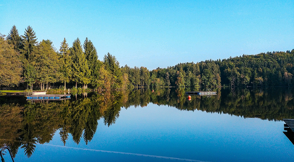
2015
Slovenia - Škocjan cave

2016
Bosnian pyramids

2023
About us
What facilities are available to us
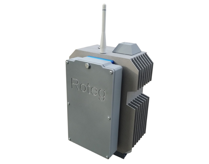
The Georadar ROTEG is suitable for archaeology down to a few meters as well as for geology down to hundreds of meters. We use it for most of our surveys. Its depth range is unmatched by any GPR in the world.

Thanks to its shielded antenna, EASY LOCATOR is mainly used for indoor surveys and for locating smaller utilities. With the 500 MHz antenna, its range is approximately 2 to 4 m.

DEEPMAX Z1 is a super powerful pulse metal detector. excels in exceptional depth range and variability thanks to interchangeable coils of different sizes. It enables reliable detection of deeply buried metal objects.
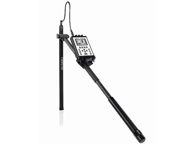
The FEREX magnetometer from FOERSTER is a high-end device for the detection of ferrous metals underground. It uses magnetometry to accurately measure magnetic anomalies caused by objects such as pipes, structures, weapons or bombs. It is ideal for utility mapping, searching for historical artefacts or pyrotechnical surveys. The FEREX excels in high sensitivity, accuracy and easy handling, making it a reliable tool even in difficult terrain.
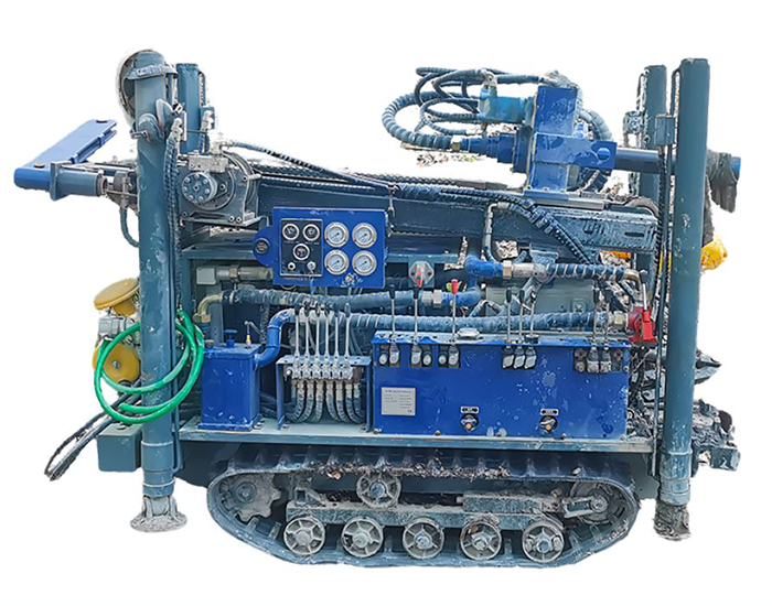
The RCF180 is designed for maximum efficiency and accessibility in the field. Thanks to its hydraulic system and rubber tracks, it can handle movement even in challenging conditions, while its compact design makes it easy to transport and deploy in different locations. It can drill to depths of up to 160 metres, making it the ideal tool for a wide range of projects. Combined with our professional services, we offer tailor-made solutions - from drilling anomalies to digging wells that we can equip with the appropriate pump.
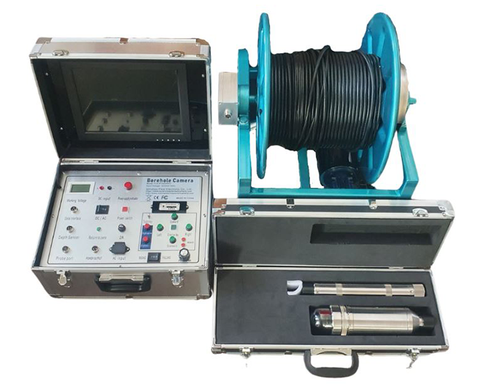
The FLX-PT2000REC inspection camera is equipped with a 360° rotation and 180° tilt head, allowing detailed inspection of drilled cavities and anomalies in HD resolution. Thanks to the automatic electric winch, it ensures accurate depth measurement and easy handling up to 150 metres. With an IP68 rating and pressure resistance up to 20 MPa, the camera is fully functional for underwater work, making it ideal for professional inspections of boreholes and other underground structures.
Rudolf Tengler - RTGPR
Černokostelecká 90
100 00 Prague 10 - Strašnice
Czech Republic
Mobile: +420 608 702 278
E-mail: rudolf@rtgpr.com
ID: 76143082
VAT: CZ8509021026
I am a VAT payer.