
Germany - Lake Tüttensee (2015)
The Bavarian lake Tüttensee has been the subject of controversy in professional circles for many years. Some claim that it was created by glacial activity, others that it is a crater after a meteorite impact. The aim of this scientific expedition was therefore to test which of the theories is the correct one. We measured several line profiles west and southwest of the lake. We started the first profiled on the meadow and we crossed the mound with 6 m long antennas to the top of the mound about 20 m above the lake - the dense forest did not let us go any further.
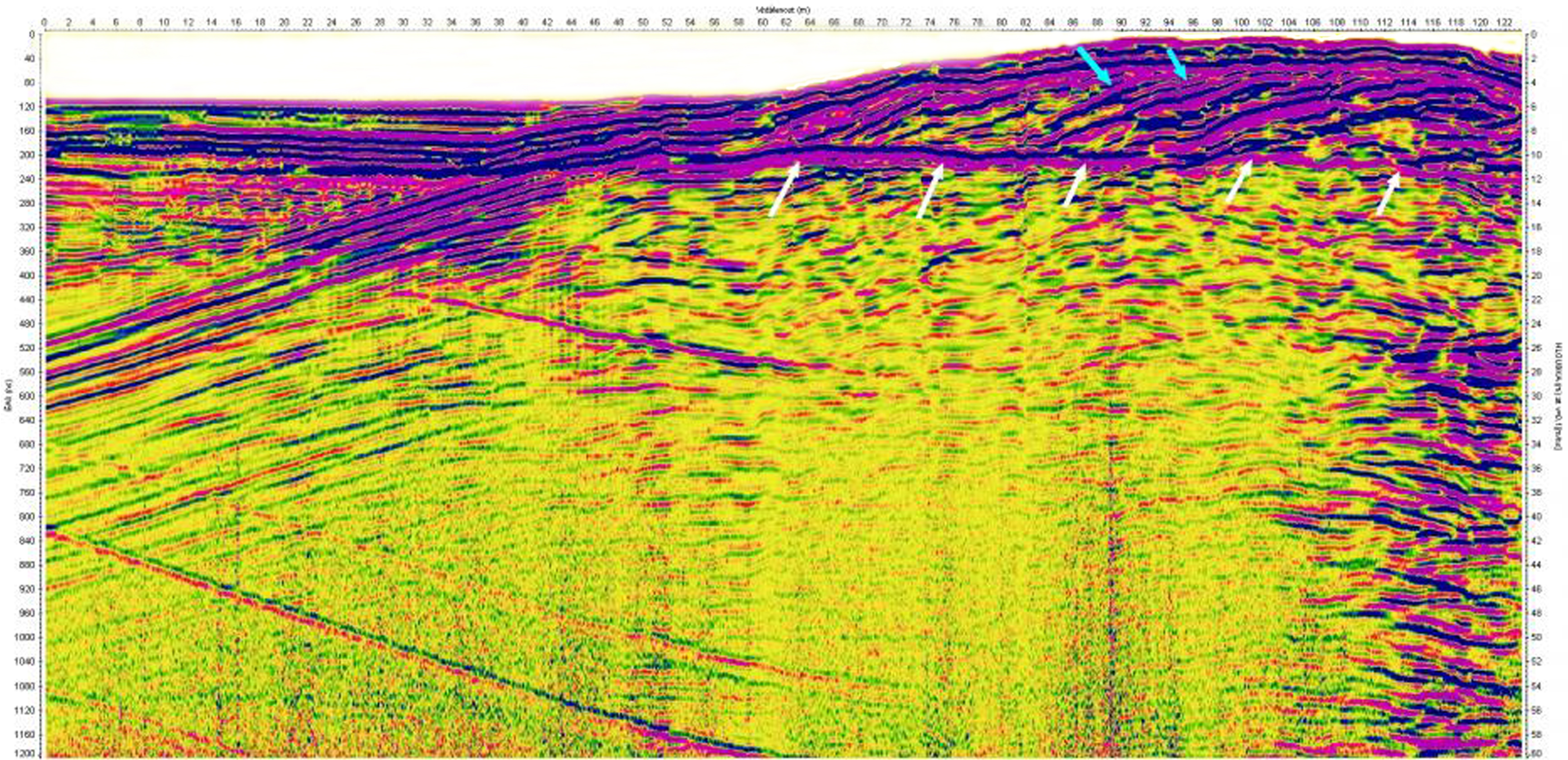
The radargram shows the almost horizontal line of the original surface (white arrows) and the sloping layers in the area of the mound. These may have been caused by landslides and the washing away of a much higher mound by rainfall. In the right part of the picture you can see the changes in the structure of the dolomite up to a depth of 60m.
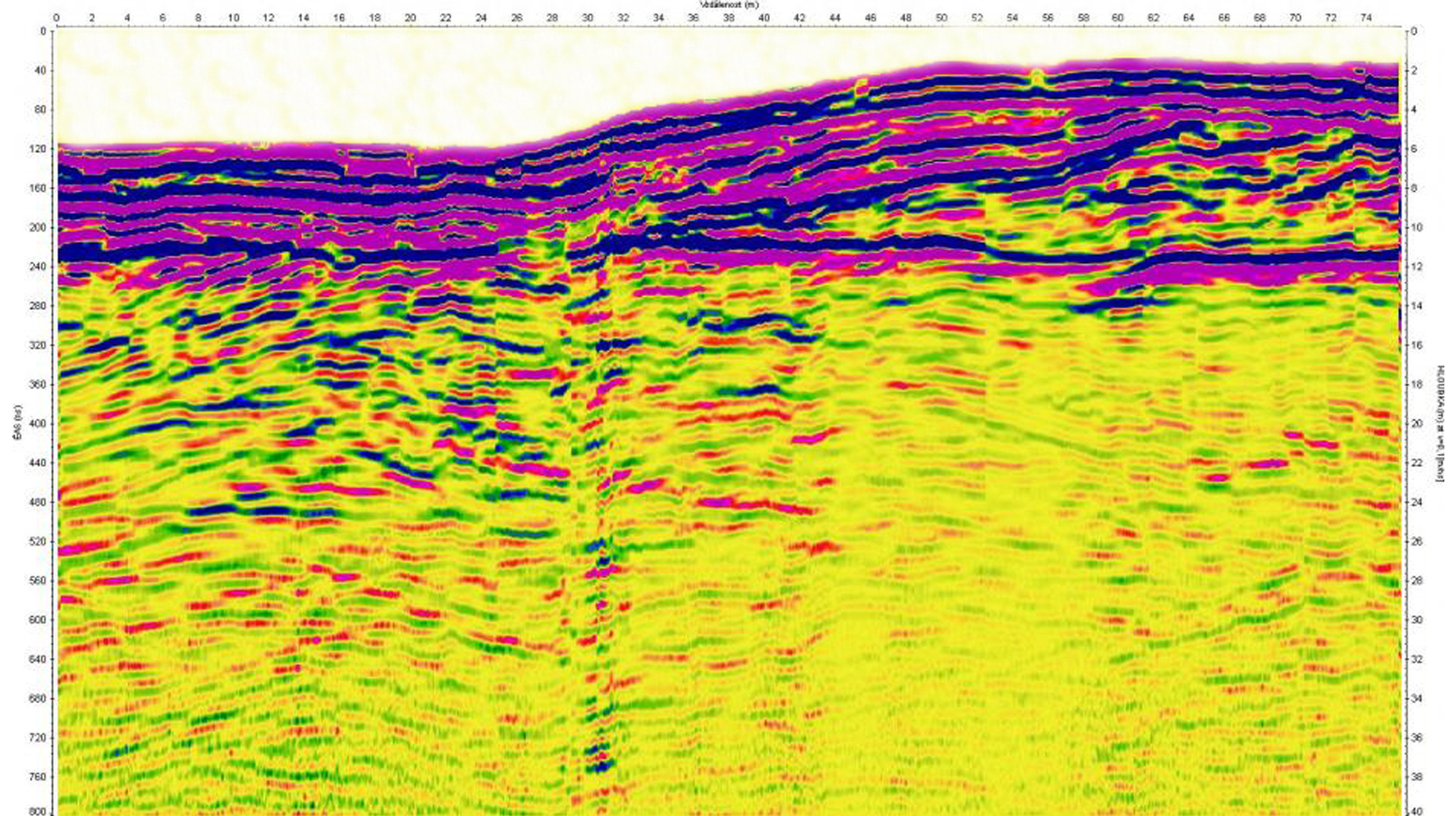
The next profile ended about 50m from the lake and also shows gradual layering over a flat interface.
According to the measured data, it seems that the mounds in the western part may have been eroded after the meteorite impact.
The results from this measurement are part of the paper The Chiemgau Impact: research in a Bavarian meteorite crater strewn field, available in PDF
The results from this measurement are part of the paper The Chiemgau Impact: research in a Bavarian meteorite crater strewn field, available in PDF
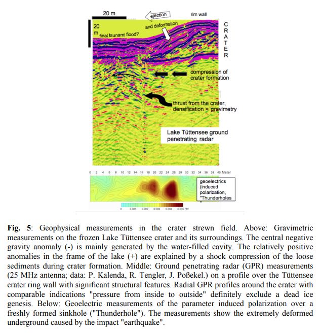
Excerpt from the publication The Chiemgau Impact: research in a Bavarian meteorite crater strewn field