
What is GEORADAR?
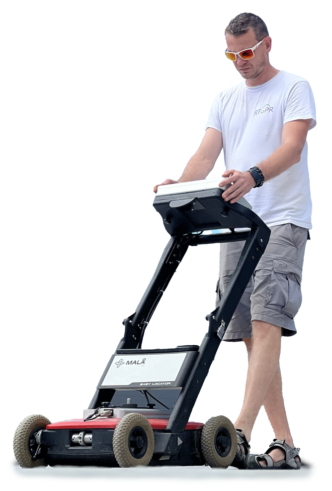
GeoRadar (GPR) is currently one of the most advanced and widely used technologies for non-invasive subsurface exploration. Its advanced design allows for compact size, easy handling and high survey speed, making it an ideal tool for a wide range of applications - from construction and archaeology to the detection of deep geological changes. Its ability to provide accurate information on the composition, properties and anomalies in the subsurface makes GPR a key element in the planning and execution of all kinds of construction projects.
As a rule, it consists of:
- Transmitters (generator of short electromagnetic pulses that penetrate the ground),
- Receivers (records reflected pulses and their characteristics),
- Antennas that transmit and receive signals on specific frequencies,
- A computer that controls the measurements and records the results.
The frequency of the antennas affects the GPR capabilities:
- Low frequencies = long antennas -> greater depth range but poorer resolution.
- High frequencies = short antennas -> less depth range but higher resolution
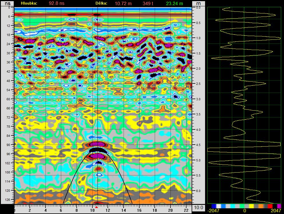
Georadar (GPR) works on the principle of transmitting electromagnetic signals into the subsurface using an antenna, and these signals are partially reflected back as they pass through interfaces of materials with different permittivity or conductivity, such as soil, rocks, water, cavities and other objects. The reflected signals are picked up by a second antenna with a receiver that converts them into digital form for further processing using an analogue-to-digital converter. The propagation and quality of the signals are influenced by environmental properties such as humidity, composition and density of materials. The resulting data is finally analysed and displayed in the form of a radargram - a two-dimensional graph that provides a visual overview of structures and anomalies in the subsurface.
What is RADARGRAM?
Possibilities and use of GPR survey
We offer professional underground and underwater exploration services that can be used in a wide range of situations:
Focus of utility networks
- Plastic gas pipes
- Metal and plastic water and waste pipes
- Location of the water leak and disturbed subsoil
- Ceramic and concrete waste channels
- Telecommunication fibre optic cables
- All metal pipes and cables
Pre-construction survey
- Locating cavities, buried cellars and older building foundations
- Plotting safe routes for horizontal drilling and extrusions
- Searching for utilities and older excavations
- Determination of soil layers and bedrock levels
- Determination of line routes under water bodies
- Identification of geological faults
Inspection and exploration of underground and underwater objects
- Concrete objects - inspection of metal fittings
- Condition of the subsoil under roads - cavities, thickness of sub-base
- Measurement of landslides of roadways and their shoulders
- Searching for buried black dumps and trativuods
- Locating lost barrels of chemicals or old ammunition
- Hidden object mapping for criminology and archaeology
- Measurement of sediments in rivers, ponds and muddy water bodies
- Search for sunken objects